With no time to lose, CCP researchers had to assess the deadly Ebola epidemic as it swept across Liberia late last year. In what counties, specifically, was the disease spreading? Did people understand how it was transmitted? Were they confident they could avoid contracting Ebola or recover if they did? Whom did they trust to deliver accurate information about the virus?
To assist the Ebola response mid-crisis, CCP researchers commissioned an SMS-based mobile survey using a database of 1.3 million mobile subscribers in Liberia. In less than a week, the research team received the results, based on answers from 1,000 respondents, and provided the program with specific information that was used to develop effective communication messages.
Later, CCP researchers also deployed a mobile survey to poll the public about trusted sources of information. The results helped inform radio spot taglines, ensuring the sponsor of the radio message was indeed a trusted source.
With the innovative use of mobile services, electronic data capture methods and geographic information systems (GIS), CCP’s research team is increasingly “utilizing newer and mobile technologies in the field” says Senior Research Assistant Amanda Berman. “There are of course times when paper and pen are more appropriate, but we are integrating technology more and more when it fits the needs of the program.”
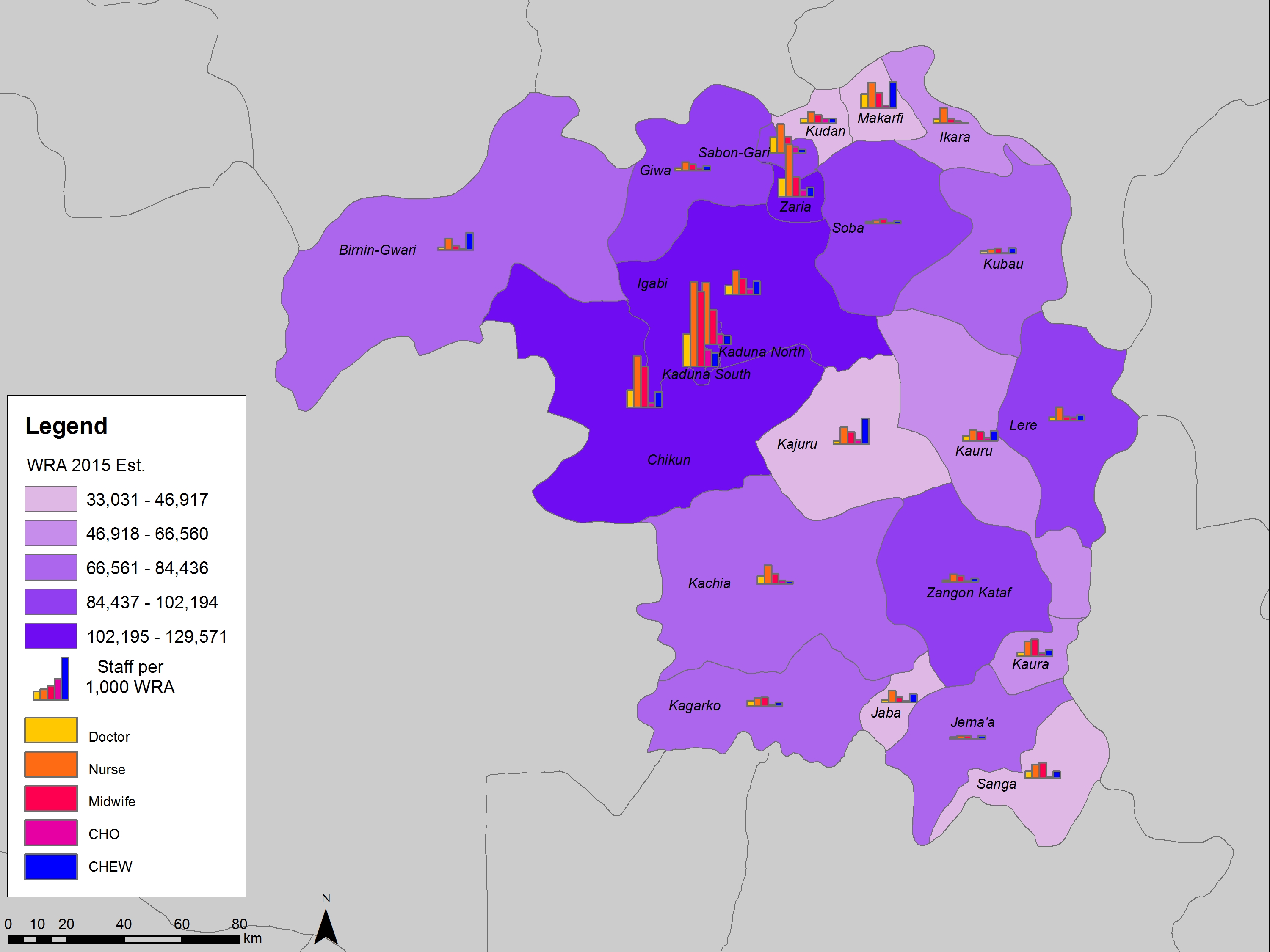
The mobile survey is one of several technological tools that CCP’s research department has adapted to monitor and evaluate health communication projects on the ground. To map health facilities for the Nigerian Urban Reproductive Health Initiative (NURHI), the research team relied on a mobile electronic data collection method that delivered results from GPS-enabled Smartphones in real time.
The health facility data were then applied on to an interactive map using GIS, which allowed for a geospatial representation of the data that provided a more vivid picture of each facility’s characteristics and service provision. With a click on a point on the map, a popup gave a profile of the facility located there and its specific capacities and capabilities, while crucially taking into account geographic location.
“We’re in a 3D world, and utilizing GIS takes that into account,” Berman says. “If you see, for instance, that a health facility is in a really remote place and that the surrounding roadways are impassable during rainy season, you have to ask, ‘How are you going to restock them?’ It’s not just where the facility is, but what is the context, what is the full picture?”
In the near future, the research division sees more potential for these tools to hone monitoring and evaluation of CCP projects. “We need to monitor the behavior change process, not just final outputs or project targets,” Berman says. For example, “in monitoring a maternal and child health project, we want to know more than just the number of women who sought emergency services; we want to track the increasing knowledge across communities in recognizing danger signs during pregnancy, if they feel confident seeking care, and whether they finally seek services.”


